Yosemite Valley and Half Dome

Photos © Peter Mansbach, May 1978, July-Aug 1991, and Oct 2005
No commercial use without written permission

Yosemite Valley, where most visitors to Yosemite National Park (California) go, gets my nomination for the most beautiful spot in the country. Here are a few photos of major landmarks in the valley, followed by some shots of my climb to the top of Half Dome. I've been to Yosemite eleven times, six of which included stops in the Valley.


Yosemite Valley from Discovery View
Yosemite Valley, from Discovery View, aka Tunnel View, July 1991

This is probably the most famous view of the Valley, taken from Discovery View, a turnoff on the road to Glacier Point. The turnoff is adjacent to the mile-long Wawona Tunnel, and on Park Service maps it is called Tunnel View. El Capitan is on the left, Bridal Veil Falls on the right, and Half Dome is visible in the background center. The mountain to the left of Half Dome is Clouds Rest. I hiked to the top of Clouds Rest in 1986, my first backpacking trip. Yosemite Falls (shown in photos below) is hidden behind El Capitan.


Sunset
Sunset from Valley View, Oct 2005
El Capitan is on the left. Cathedral Rocks are on the right. The Merced River in the foreground.


Yosemite Falls
Upper Yosemite Falls, seen from Yosemite Valley, July 1991
The lower falls are not visible from this vantage.


By July (above), the waterfalls are starting to dry up. They're really spectacular in spring, with all the snowmelt. To the right is a photo of the upper falls in May, which I took in 1978 on a hike from the Valley to the top of Yosemite Falls. It is actually two photos, stitched together on the computer - 24 years after they were taken! At that close distance, the waterfall didn't all fit on one negative. You can sense the power of the spring torrent dropping 1430 feet.

I visited again in October, 2005. Yosemite Falls was completely dry.

Yosemite Falls in May
Upper Yosemite Falls from the trail, May 1978


Bridal Veil Falls
Bridal Veil Falls, July 1991
Bridal Veil Falls (left) is another popular sight in Yosemite Valley.

Nevada Falls (right) is a popular dayhike destination. The mass of granite to its left in this photo is called Liberty Cap. Along the way one also passes Vernal Falls. I did not do this as a dayhike, but rather passed this way returning from the top of Half Dome (see below).

Nevada Falls
Nevada Falls and Liberty Cap, Aug 1991


Half Dome


Half Dome is perhaps the most widely recognized feature in Yosemite. It towers 5000 feet above the valley floor, which is itself at about 4000 ft elevation. This photo was taken in May, 1978. Half Dome is on the south side of the Valley, in other words it faces north. So snow is still visible here in May.

Half Dome from Yosemite Valley
Half Dome from Yosemite Valley, May 1978


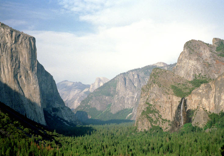
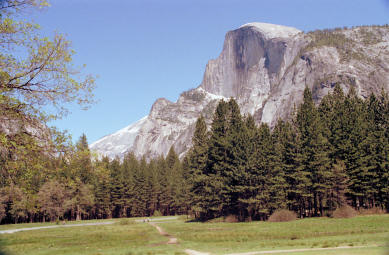
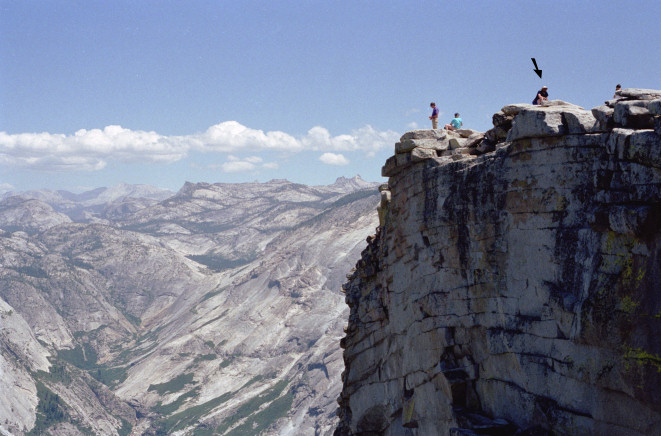
This view of Half Dome was taken from Glacier Point in October, 2005. One can drive to Glacier Point. Here you can see the full height of this massive granite formation, towering 5000 ft above the valley floor.

One can hike from the Valley to the top of Half Dome and back in one extremely strenuous day. I know people who have done it. I prefer a more leisurely approach. One such possibility is to hike up to the backpacker camp in Little Yosemite Valley, on the back side of Half Dome, and camp there overnight. On the second day one then hikes to the top of Half Dome and back to Little Yosemite. The third morning suffices to hike back down to the Valley.

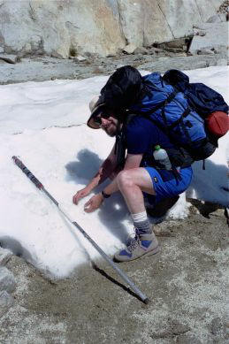
My own trek to the top was longer. I hiked with the Sierra Club. We drove to Glacier Point, and hiked a circuitous route past Ottaway Lakes, through Red Peak Pass, and down the Merced River to the back side of Half Dome. About 40 miles in 7 days.

Half Dome from Glacier Point
Half Dome from Glacier Point, Oct 2005


Half Dome from Four Mile Trail
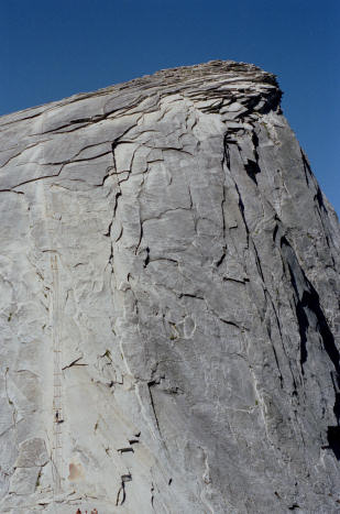
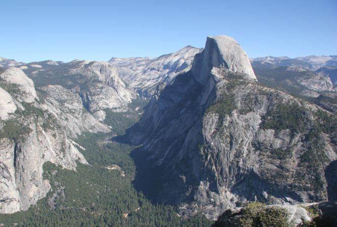
Half Dome from Four Mile Trail, Oct 2005

We note that the Four Mile Trail is actually closer to 5 miles in length. 
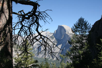
And if one takes the bus from the valley to Glacier Point, as I did, to hike the trail one-way, one finds at the end that it's yet another mile to where the bus started from, and where one left one's car.


The cables up Half Dome I do not do technical climbing (with ropes and such). Actually, I am afraid of heights. So, no, I did not climb the face of Half Dome. I, along with most hikers, hike around to the east side. The climb of the dome itself is done in two stages. The first half is a steep hiking trail. The second half is even steeper, too steep for normal walking. The park rangers have put up cables along this route, for people to hold onto. Or hang onto, for dear life. This photo shows the cables, on the left side of the photo. A hiker is part way up.

The cables up Half Dome
Aug 1991


The top at last.

This photo was taken by another member of the Sierra Club hiking party. She found a spot where the top juts out a bit, so you can see the face of Half Dome, and me on top (arrow).

The 360° panorama from the top is magnificent. Unfortunately, it was getting a bit hazy, and the photos are not so spectacular.

Peter atop Half Dome
Me, on top of Half Dome, Aug 1991  Photo by Mary Meusgeier

Me with pack, in snow Me, with pack, near Red Peak Pass, Aug 1991 (elev 11,200 ft).
Yes, I had a beard then.
Photo by Ray Niekamp, I think
You may contact me at pmansbach@aol.com

Back to Peter Mansbach's Home Page
Photos of my 2010 trip to Yosemite Valley, and of the Panorama Trail
Photos of my 1997 trip to Yosemite's Matterhorn Canyon

Other Yosemite Links:
Park Service news, traffic, etc
Yosemite Links
Yosemite Half Dome Webcams (click the "Time Lapse Movies" animation!)