San Juan Mountains
Colorado
Telluride - Silverton - Durango
Photos © Peter Mansbach, Sept 2004.
No commercial use without written permission.
On this trip I drove the scenic San Juan Skyway loop, a series of highway segments
through the San Juan Mountain Range in southwestern Colorado
(click here to view map, in a separate window).
The loop
passes through Durango, Cortez, Telluride, Ouray, Silverton, and back to Durango, for
a total of 240 miles.
Along the way I did a number of day hikes. The high points of the trip, pictured on
this page, were Telluride, and the Durango-Silverton Narrow Gauge Railway.
Telluride
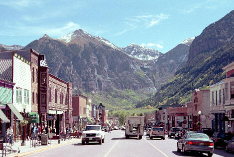
The town of Telluride is about a mile long, and only four blocks wide.
It is wedged between mountains, rising directly from the edge of town in the short
north-south direction, and only a bit further off toward the east. The photo on the
right is looking east along Colorado Avenue, the main street. The town itself is preserved as a
historic district. (The newer ski resort condos are located in Mountain Village, several miles
away on the other side of Coonskin Mountain.)
I hiked to Bridal Veil Falls, east of town; Bear Creek Canyon to the south; and the
Jud Wiebe Trail to the north. The latter two trails start right from the edge of town. The next
two photos were taken from the Jud Wiebe Trail.
|
Downtown Telluride
|
| |
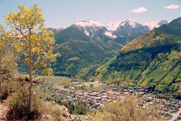
Telluride, seen from the Jud Wiebe Trail
|
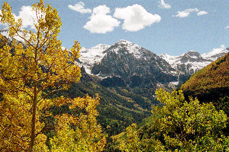
Mountains near Telluride, with aspens turning color
|
|
River Trail
|
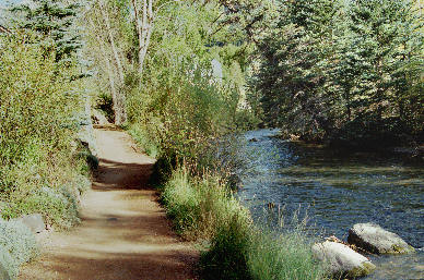
One of the charms of the town is the San Miguel River Trail, a path that
runs the length of the town (the long way, east-west), next to the river,
and away from vehicular traffic.
I was able to walk from my motel to any of the many restaurants in downtown
Telluride without seeing or hearing cars until I turned north for the last
block or two across town. |
The Durango-Silverton Narrow Gauge Railroad
The Durango-Silverton Narrow Gauge Railroad was originally built to carry silver and
other ores from the mines in the mountains to the major rail lines to the south.
"Narrow gauge" refers to the distance between the two rails, much less than the standard
gauge used by most railroads. This allowed laying track on narrower ledges and around
sharper curves, resulting
in less expensive construction in this rugged terrain. The mines have been abandoned,
and the railway is now operated as a tourist attraction.
They still use coal-burning steam locomotives to pull the trains.
I rode that railway, from Durango to Silverton and back, on the last day of my trip.
Despite having seen lots of beautiful scenery on the rest of the trip, I was absolutely
awestruck by the incredible mountains rising up from the Animas River. (The original
Spanish name of the river is El Rio de las Animas Perdidas, the River of Lost
Souls.) The railroad
pretty much follows the river for the 45 miles from Durango to Silverton.
I was on the next-to-last car of the train. The photos below were taken
as the train rounded curves, so the front of the train is visible.
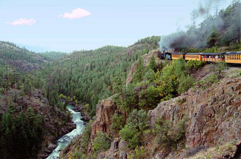
Durango-Silverton Narrow Gauge Railroad
on "The Highline" shelf overlooking the Animas River
|
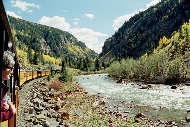
Railroad, Animas River
|

Railroad, Animas River
|
Sept 2007 trip to Colorado: Crested Butte and Aspen
Return to my home page